![]()
| • Home | •• Remote Sensing | ••• Photography From The Air | ••••Tethered Blimp Photographs |
|
|
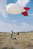
The blimp in action. |
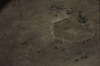
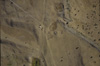
| Blimp photgraph of Area A: a street runs diagonally from bottom right, the "palace" is in the angle between the tether rope and the street. |
|
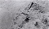
Blimp photograph showing the terraces in Area F, within part of which geophysical survey has revealed urban blocks containing various buildings. |
 |
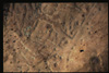
Vertical blimp photograph of part of the area, including Area B at the centre. |
 |
The medieval castle photographed with the blimp. |
 |
The palace and environs. |
 |
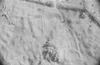
The north end of the city showing the ruinous defensive wall, tower and enclosure containing a large building beneath the modern animal pound. |
 |
Blimp photograph showing details of Area B. |
 |
The south gate and defences with the wall, towers and stone glacis. Inside is a small pool and a building. |
 |
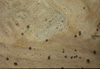
Blimp photograph of the west end of the wide street (c.18m.) and part of Area E. Despite later tumuli, the urban blocks and streets are clear. |
 |
Blimp photo of the north-west corner of the extramural temple at Karabaş. |
 |
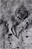
A detail of the north-east corner. |
 |
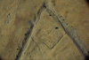
Blimp photograph of the "Cappadocian Gate". |
![]()
|
|
|
• Introduction
• Selected Images
• History
• Exploration
• Remote Sensing • Excavations • Finds • GIS • The City • Regional Survey • Preliminary Reports • Project Publications • Bibliography |