Kerkenes Home Up << Page 1 >> Index


Abstract :

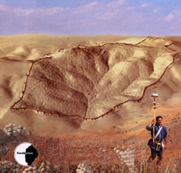
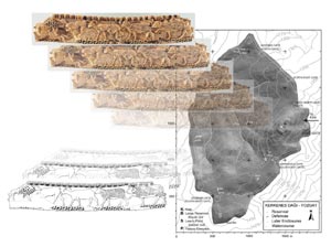
Exploration of the ancient remains on the Kerkenes Dag is unravelling the story of this mountain-top Iron Age capital in Central Turkey. Geographic Information Systems (GIS) provide the platform for the archiving and integration of different data sets: photographic, GPS, topographic and geophysical. One innovative goal of the Kerkenes Project is experimentation with GIS. The aim is to ascertain the extent to which powerful analytical GIS tools can be used in furthering our understanding of the urban dynamics of this ancient city. The results will enhance our perceptions of the cultural processes that underpinned its centralised planning and subsequent development.


  Exploration at Kerkenes  


Location :

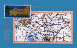
The Kerkenes Dag is a low, c.1.500m, granitic mountain in central Turkey that dominates the surrounding region The ancient site lies south-east of the regional capital, Yozgat. Research permits are issued by the General Directorate of Monuments and Museums, Republic of Turkey Ministry of Culture. The high level of support received from national and regional authorities, institutions and corporations is invaluable.


Sahmuratli Village and the Kerkenes House:

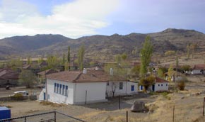
The site is most easily approached from the village of Sahmuratli, 12km south-west of Sorgun. The Expedition House is in the village. Some of the villagers have worked with us since 1993 and have played a key role in the collection of remote sensing data. The village exudes traditional Anatolian hospitality.


Site and Team in 2001:

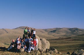
The extensive results from 10 years of research demonstrate the dedication and enthusiasm of the team, including that essential element of men employed from the village. We are indebted to all who contribute to each and every aspect of the project throughout the year.


The Kerkenes Office:
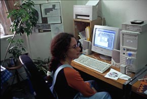
We are very grateful to the Faculty of Architecture at the Middle East Technical University (METU/ODTÜ) for the use of a Project Room. Donations, essential to maintain both research and facilities, are channelled through the METU Development Foundation.


Acknowledgements:
The Project falls under the auspices of British Institute of Archaeology at Ankara (BIAA) and METU. Collaboration with the UC Berkeley and the SUNY Buffalo has been most fruitful. Main sponsors since 1993 have been the BIAA, METU, Yibitas Lafarge, the National Geographic Society, the British Academy, Raymond and Beverly Sackler and The Joukowsky Family Foundation. GEOSCAN, ESRI, ERDAS and Islem GIS assist with software. METU Computer Centre provides technical support and hosts our web page. The Faculty of Architecture at METU awarded a research grant for GIS Studies co-ordinated by Prof. Ömür Bakirer to which Mr Refik Toksöz contributed expertise in 3D modelling. Generous support was received from the UC Berkeley Stahl Fund, The Charlotte Bonham Carter Trust, Bell Helicopter, Yenigün and others. The complete list of Project Sponsors and Participants can be found in the annual Kerkenes News and on the Kerkenes Web Page:


The Kerkenes Web Page:
The role of the Kerkenes Web Page is not only to acknowledge and thank everyone for their participation, contribution and support, but also to disseminate results and data to a wide international audience of scholars, students, and public. This electronic publication allows a certain level of interaction on the part of the user in ways that are impossible with more traditional publication and, at the same time, permits the extensive use of full colour graphics.


Kerkenes Home Up << Page 1 >> Index