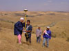
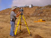
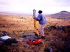
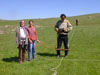
THE TEAM
Figure
1: Team members
Prof. Dr. Omur
Bakirer
Project Coordinator, Dept. of Architecture.
Inst. Francoise
Summers
Architect and Co-director of the Kerkenes Survey, Dept. of Architecture.
Assoc. Prof. Emre
Madran,
Coordinator for photogrammetry, Dept. of Architecture.
Inst. Refik Toksoz
3D representations and virtual reality, Dept. of Industrial Design.
Nahide Aydin
Kerkenes Project Assistant, Student of METU Archaeometry Graduate
Programme.
Koksal Sanli
Assistant for GIS, Student of GGIT Graduate Programme at METU.
Kemal Gulcen
Photogrammetry, Dept. of Architecture.
Other
key members of the Kerkenes Project consulted for their relevant
expertise:
Dr. Geoffrey Summers
Archaeologist and Director of the Kerkenes Survey, Dept. of Political
Science and Public Administration, METU.
Res. Ass. Scott
Branting
GIS Research at SUNY Buffalo, USA, surveyor (GPS data collection
and processing).
Students
who participated in the GIS Pilot Study:
Firat Ant, Dept. of Industrial Design;
Ozge Basagaç, Dept. of Architecture;
Sertan Caglar, Dept of City Planning;
Umut Dervis, Dept. of Industrial Design;
Derya Ozgoc, Dept. of City Planning;
Arda Uysal, Dept. of Industrial Design;
Baris Yagli, Dept. of Architecture.