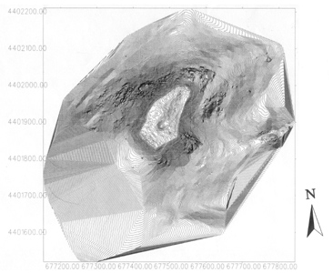
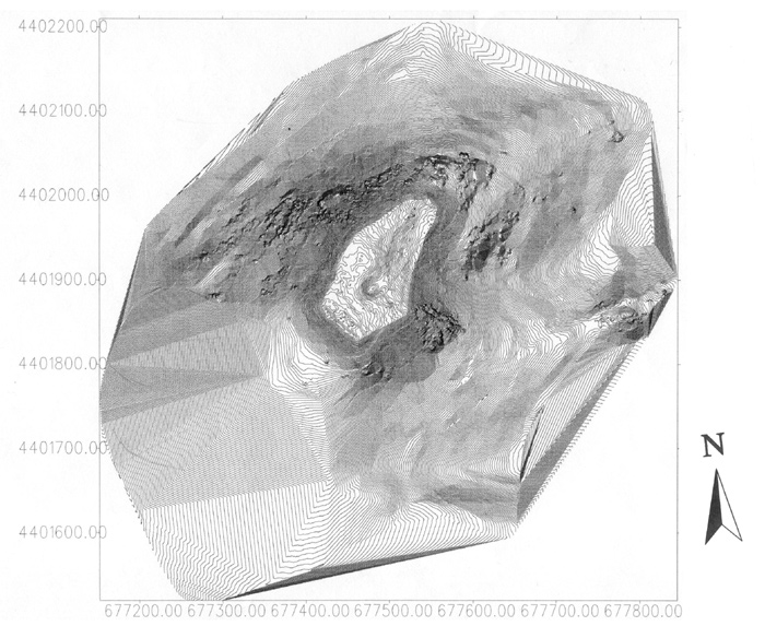
- Topographic plan of the Kale and
slopes made from the GPS survey. The image is generated from 17,000
survey readings collected in 10 days and can be displayed in a variety
of ways.
- Kale ve yamaçların GPS ölçüm çalışmaları sonucunda ortaya çıkan topografik
haritası. Bu harita 10 gün içerisinde toplanan 17.000 okuma sonucunda
hazırlanmıştır.
![]()