|
|
AIMS
OF THE SURVEY
The original aims of the survey
were to record a group of rock carvings in a valley to the west of Çekerek
and to examine the routes and passes leading northwards from the Kerkenes
Dag for evidence that would support the hypothesis that there was a
major route leading directly northwards via Eymir and Aydincik in the
second and again in the mid-first millennia BC. Research in the BIAA
library between the initial application for a supplementary grant and
finalisation of survey plans revealed conclusive evidence that the rock
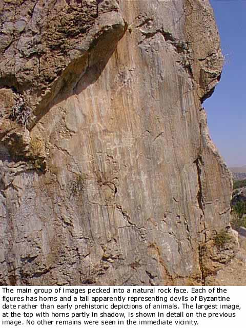
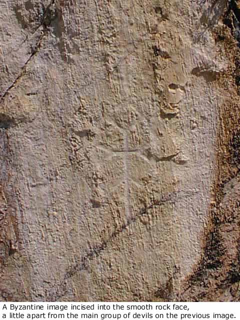
carvings were of Byzantine date, not early prehistoric as has been hoped.
I owe to David French the suggestion that the images represent devils,
hence their horns and tails that had misled us into thinking they were
prehistoric representations of animals. After consultation with Dr.
Roger Matthews and Professor Stephen Mitchell it was agreed that the
survey proceed as planned, all emphasis now being placed on the issue
of ancient routes and an estimate of the potential for more detailed
and intensive survey sometime in the future. The final aims of the project
as it went into the field were thus: 1. to test the hypothesis that
there was a route from Kusakli Höyük, Hittite Zippallanda, (Gurney 1995)
directly northwards to Ortaköy, Hittite apinuwa (Suel 1996); 2. to
test the hypothesis that the same route was used in the mid-first millennium
between the city on the Kerkenes Dag, Pteria (Herod. 76.1, Summers 1997)
and the Black Sea, especially Sinope; 3. to take a preliminary look
at the settlement pattern in the Kümbet Ovasi (Aydincik Ilce) and that
part of the Çekerek Irmak valley running eastwards from it. This seems
always to have afforded easy passage and was surely the route between
Hattusa and Alaca Höyük (?ancient Arrina) and Masat Höyük close to the
north-eastern border of Hittite territory; 4. to gain a general idea
of the potential within the region for an intensive archaeological survey
that would be combined with study of the geomorphology and make use
of GIS.
|