 |
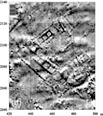
Detail of the geomagnetic map at the west side of
the central area, apparently showing an urban block with subdivisions, a prominent
3-roomed unit, linear modular buildings, and other structures. Sehrin orta batisindaki kentsel blogu ve onun içindeki 3-odali strüktürü, çizgisel modüler strüktürleri ve diger strüktürleri gösteren jeomanyetik harita.
|