Geoffrey & Françoise Summers |
|
|
Geoffrey & Françoise Summers |
|
|
|
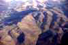
Kerkenes Dağ is a low granitic mountain, altitude c. 1,500m, on the northern edge of the Cappadocian plain (map). It is the largest Iron Age city on the Anatolian Plateau. The prominent peak dominates the landscape south of the modern highway between Yozgat and Sorgun. It lies close to the intersection of this natural route with a diversity of routes northwards to the Black Sea and southwards via the passes through the Taurus mountains to North Syria and the Mediterranean. Arguments for equating Kerkenes with Pteria are summarised below and presented in detail elsewhere (Summers 1997). This central location provides the key to understanding both its choice as the western capital of the Median Empire and the brevity of its magnificence. The mountain-top is not unusually high for a city, being only slightly more elevated than Yozgat and considerably lower than Erzurum, but it is exceptionally exposed with the greater part facing harsh cold winds that habitually blow from the north and north-west. Even in August it can be bitterly cold and in winter snow lies on the site for many more weeks than in villages on the plain below. On still summer mornings cloud wraps itself around the mountain, the cold damp mist restricting visibility to a few metres, while the surrounding plain is blessed (or cursed) with the hot, dry, dusty air of the Cappadocian Plain. Clearly, the founders chose the location with the needs of security high on their priority list, but the abundance of perennial fresh water was a crucial feature that set Kerkenes apart from other heights in the region. Page 1 |
|
|