Phase 1: 1993-1997Geoffrey and Francoise SummersKerkenes,
the ancient Pteria of Herodotus, is the largest Iron Age city on
the Anatolian Plateau, its prominent peak dominating the landscape.
Central location provides the key to understanding both its choice
as the western capital of the Median Empire and the brevity of its
magnificence. Few references occur in the ancient sources: Herodotus
locates Pteria east of the Halys River (modern Kizilirmak) and describes
it as the strongest place in that part of Cappadocia. The Byzantine
geographer Stephanos knew it to have been a city of the Medes. Our
research has shown that Median Empire possessed the ostentation
typical of ancient empires and put in place a system of control
that facilitated consolidation and expansion of Iranian power under
the Achaemenids. A new interpretation suggests that Pteria was perhaps
founded by the Medes following the collapse of the Neo-Assyrian
Empire. If so, it would have been the base from which the 5 year
war against the Lydians, culminating in the "Battle of the Eclipse"
on the 28th of May, 585 BC, was conducted. According to Herodotus,
Croesus destroyed it in 547 BC, following his divinely sanctioned
crossing of the Halys, in the mistaken belief that he would destroy
the Persian Empire rather than his own. Croesus enslaved the Pterians
and chased innocent Cappadocians from the surrounding countryside.
Lydian aggression was soon halted by the Achaemenid usurper Cyrus
the Great at the indecisive "Battle of Pteria", fought on the plain
below.
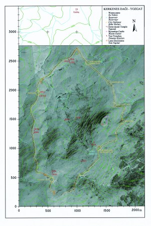
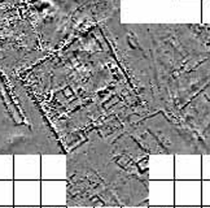
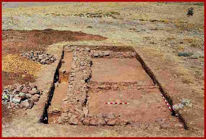
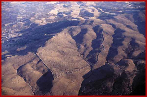
In Phase 1 of the Project mapping from rectified balloon photographs was completed, geophysical survey showed the potential of remote sensing and test trenches yielded a wealth and variety of information. The fully urban nature of the city was established, the sixth century date confirmed and the final destruction by fire, presumably by the hand of Croesus, was dramatically revealed. The defences were studied in detail. A huge complex of planned public structures was identified on the high southern ridge, including what appears to be a palatial complex, imperial stables or store houses and a stone lined pool. Centrally planned, walled, urban blocks, divided by streets, were seen to occupy the lower area and sophisticated water management was evident. Geomagnetic survey, supplemented by test excavations made in collaboration with Musa Özcan, Director of the Yozgat Museum, revealed architectural forms of Iranian inspiration, high status objects and an exquisite ivory inlay embellished with gold, silver and amber. The great temple, beyond the walls, at Karabas, was recorded and studied. Mapping the surface topography with a global positioning system and magnetic survey of buried structures with a magnetometer held out the prospect of creating three dimensional images that can be combined with both rectified balloon photographs and architectural reconstructions. Processed satellite imagery and regional survey was placing the city in its wider physical, cultural and historical environment. Methods
and Techniques
|


[ kerkenes home page | kerknews turkçe | kerknews français ]
.