-
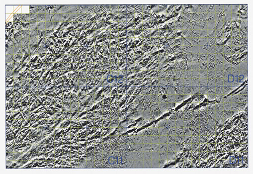
Geophysical map of the north-west portion of the site. The map is georeferenced
with
IRAS/C on the UTM projection with the Kerkenes local grid drawn in Microstation.
- Kentin kuzeybatı bölümünü gösteren jeofiziksel harita. Harita, UTM
projeksiyonunda, Microstation’da çizilmiş Kerkenes lokal kareleme sistemiyle,
IRAS/C’de jeoreferanslanmıştır.