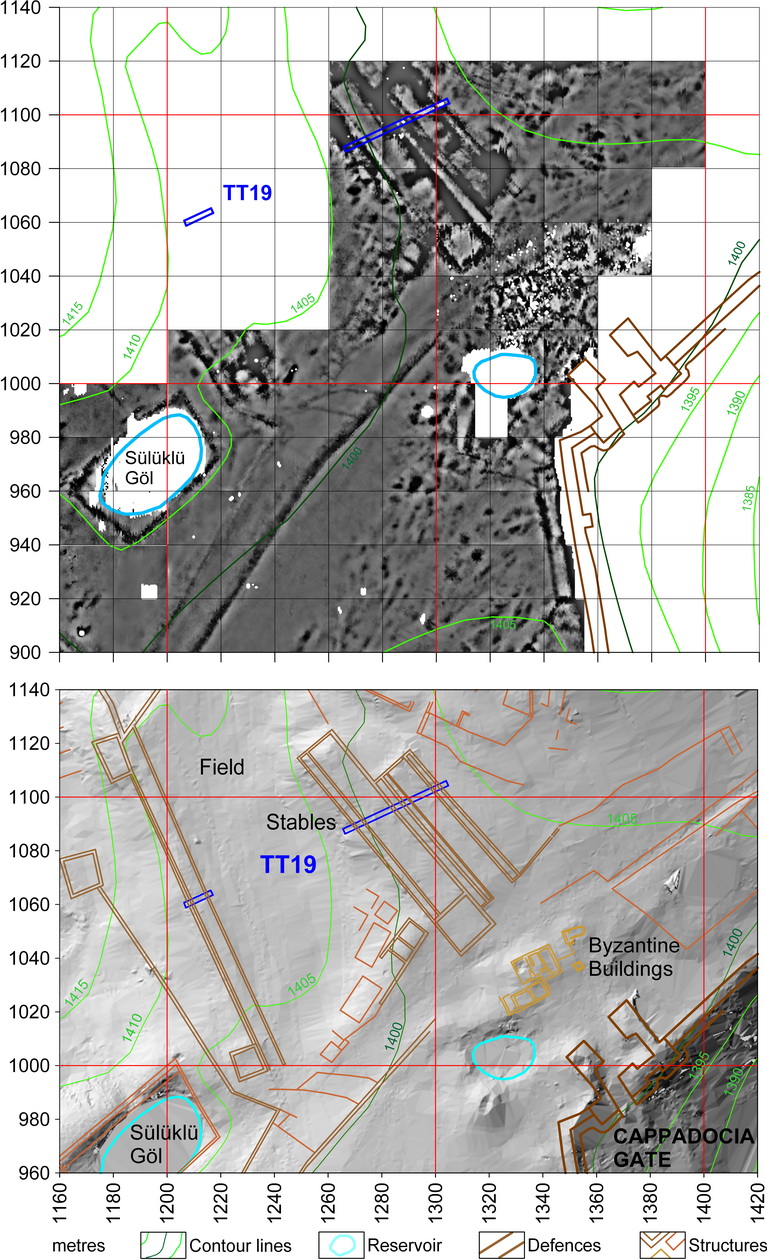
(a) Electrical resistance survey showing the long structures thought to be stables and test trench TT19.
(b) GPS map of the terraces overlaid with plans of visible remains and interpretation of geophysical surveys. Test trench TT19 was dug across the structures in 1996.
(a) Ahır oldukları düşünülen uzun yapıları ve Test Açması TT19u gösteren elektrik direnç yüzey araştırması.
(b) Yüzeyde görülebilen ögeler ve jeofiziksel yüzey araştırması tahmin planlarının, kent teraslarına ait GPS haritası ile çakıştırılması. Test Açması TT19, 1996da bu yapılar boyunca açılmıştır.
![]()