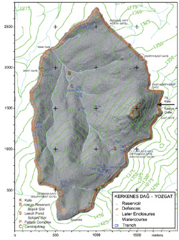
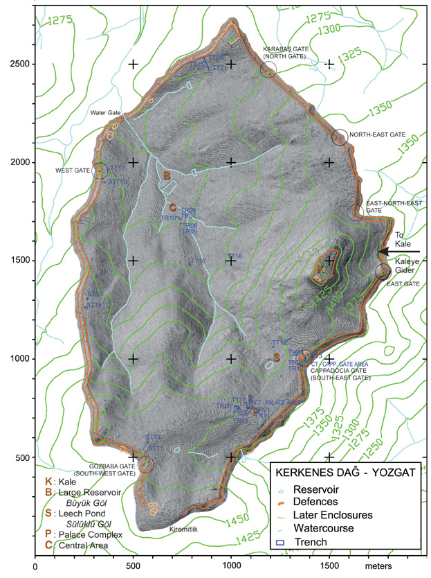
A Digital Terrain Model (DTM) of Kerkenes, made from the GPS survey, showing the city defences and the excavation areas.
GPS yüzey araştırması verileri ile oluşturulan ve şehir surları ile kazı alanlarını gösteren sayısal arazi modeli (DTM).
![]()
|
A Digital Terrain Model (DTM) of Kerkenes, made from the GPS survey, showing the city defences and the excavation areas. GPS yüzey araştırması verileri ile oluşturulan ve şehir surları ile kazı alanlarını gösteren sayısal arazi modeli (DTM). |
|
|