|
-
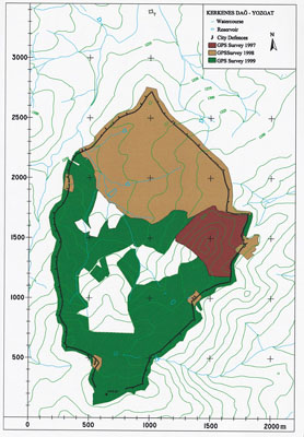
Map of Kerkenes Dag showing the progress of GPS survey at the end
of the 1999 field season. Detailed surface mapping now covers some
80% of the city.
- 1999 sezonu sonunda GPS araştırmaların ilerleyişini gösteren Kerkenes Dağı haritasi. Kentin yüzey topografyasını belirleme çalışmaları artık alanın %80 ini kapsamıştır.
|
|||||||