 |
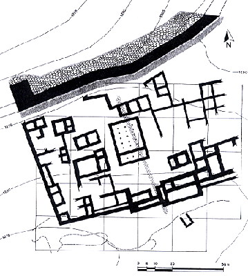
- Plan of an urban block in Area B. Test Trench 15, measuring 2.00 by 72.00m, was dug through the centre of the block in order to evaluate the geophysical map (Fig. 4). Structures have been planned from a combination of balloon photography, surface mapping, geomagnetic survey and the test trench. |