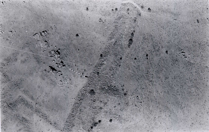
- Şehir savunma sisteminin ölçülen, çizilen ve dijitize edilen bir bölümünün fotoğrafı (bakınız Şekil 6 ve 7'de sağ alt kenar). Duvar fotoğrafın ortasında diyagonal olarak yer alıyor ve dış kulelerden biri de açıkça görülüyor. Duvar yüzü ve taş döşeli şevlerin büyük bölümü moloz altında kalmış fakat taş döşeli şevlerin bir kısmı fotoğrafın üst tarafında düz bir çizgi halinde görülebiliyor; duvarın en üst kısmında ise çobanlarca açılmış bir yol yer alıyor. Duvarın içinde kalan bölgede orta kısmı doğal kayalar dolduruyor, alt kısımlarda ise yapı kalıntıları var. Naylon ölçek 10m. uzunluğunda; duvarın üzerinde ve her iki yanında toprakta görülen beyaz noktacıklar ise beyaz kireçle işaretlenmiş olan ve ana planda takeometrik olarak bağlamış bulunan kontrol noktaları. Fotoğrafın merkezinden sola doğru ise balonun yerden idaresinde kullanılan halat görülebilir.
![]()