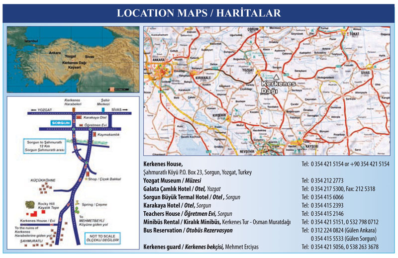
Figure 2. (a) Map of Turkey showing the location of Kerkenes on the northern edge of the Cappadocian Plain.
b) Road map of Central Anatolia showing location of Kerkenes Dağ, the nearby town of Sorgun and provincial capital of Yozgat.
c) Directions to the village of Şahmuratlı.
Şekil 2. (a) Kapadokya Platosu'nun kuzey ucunda yer alan Kerkenes'in konumunu gösteren Türkiye haritası.
(b) Kerkenes Dağ, Sorgun İlçesi ve Yozgat İl Merkezinin konumlarını gösteren Orta Anadolu karayolu haritası.
(c) Şahmuratlı Köyü'ne ulaşımı gösteren yol krokisi.