Skip to main content

Progress
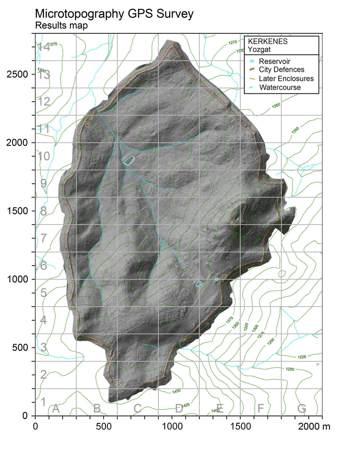
GPS Results
Digital Elevation Model (DEM) of the city in UTM WGS84 coordinate system produced from GPS data.
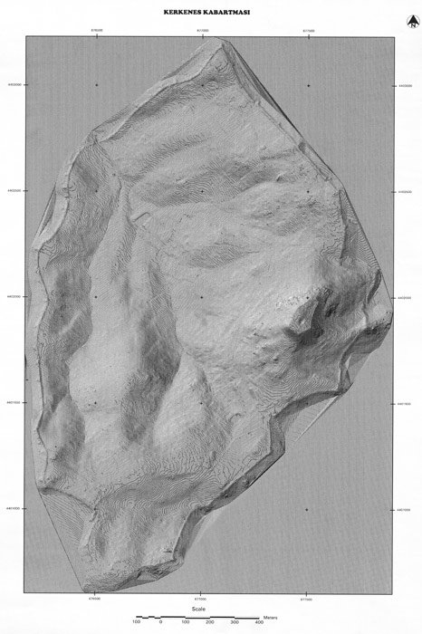
Triangulated Irregular Network (TIN) model created in ArcView 3D Analyst from 1,400,000 GPS readings.
Last updated