 |
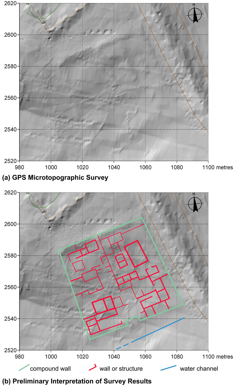
(a) GPS topographical survey map and (b) preliminary plan of structures drawn from geophysical survey imagery and groundtruthing of the urban block in the northern portion of the site. Kentin kuzeyinde kalan kentsel yapı adasının jeofizik yüzey araştırması görüntüleri ve arazi doğrulaması yardımıyla hazırlanan (a) Topografik GPS tarama haritası ve (b) yapıların öncül planı. |
 |
An urban block in the northern sector of the site, adjacent to the northeast stretch of the city wall. Kentin kuzeyinde kalan kentsel yapı adasının jeofizik yüzey araştırması görüntüleri ve arazi doğrulaması yardımıyla hazırlanan (a) Topografik GPS tarama haritası ve (b) yapıların öncül planı. |
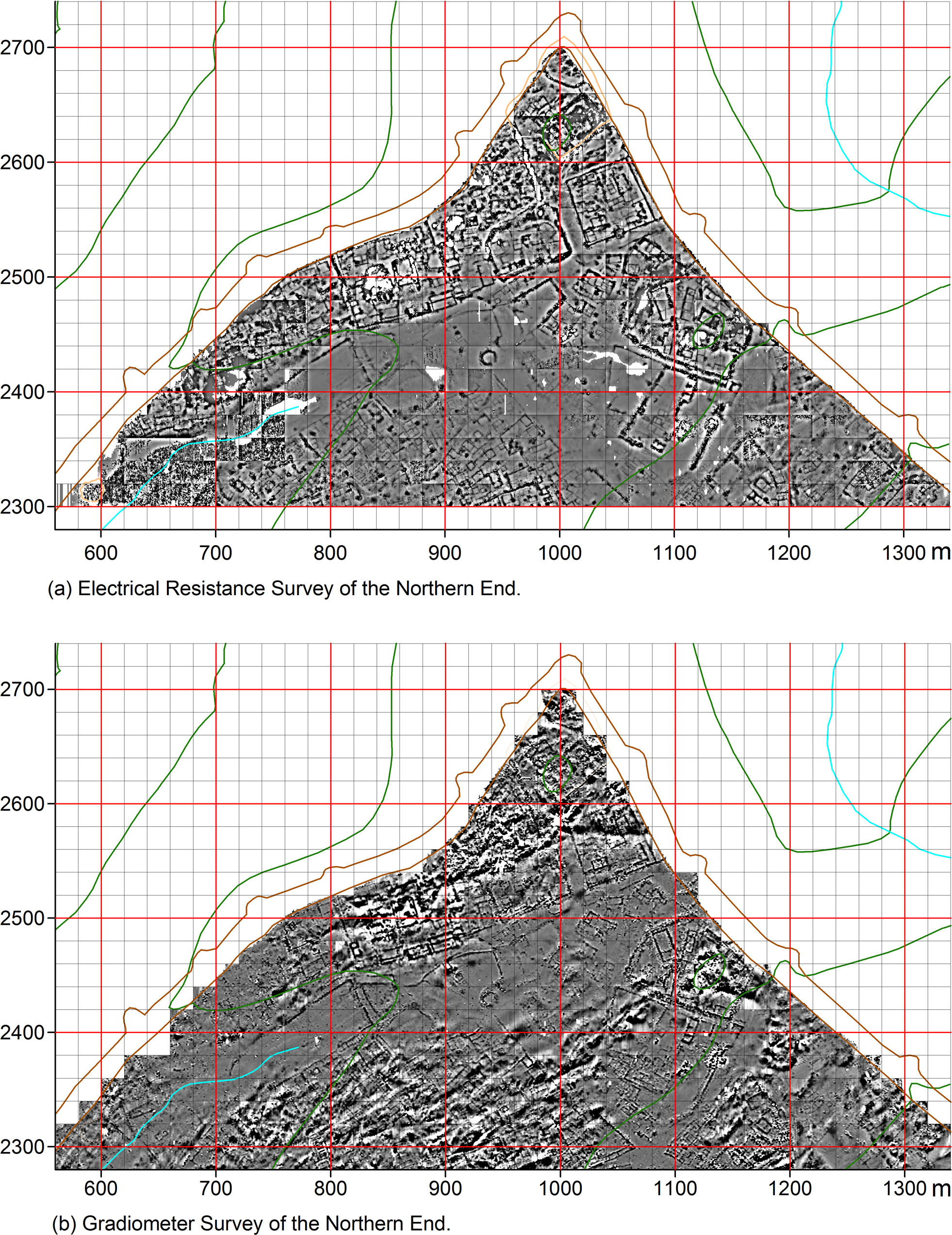 |
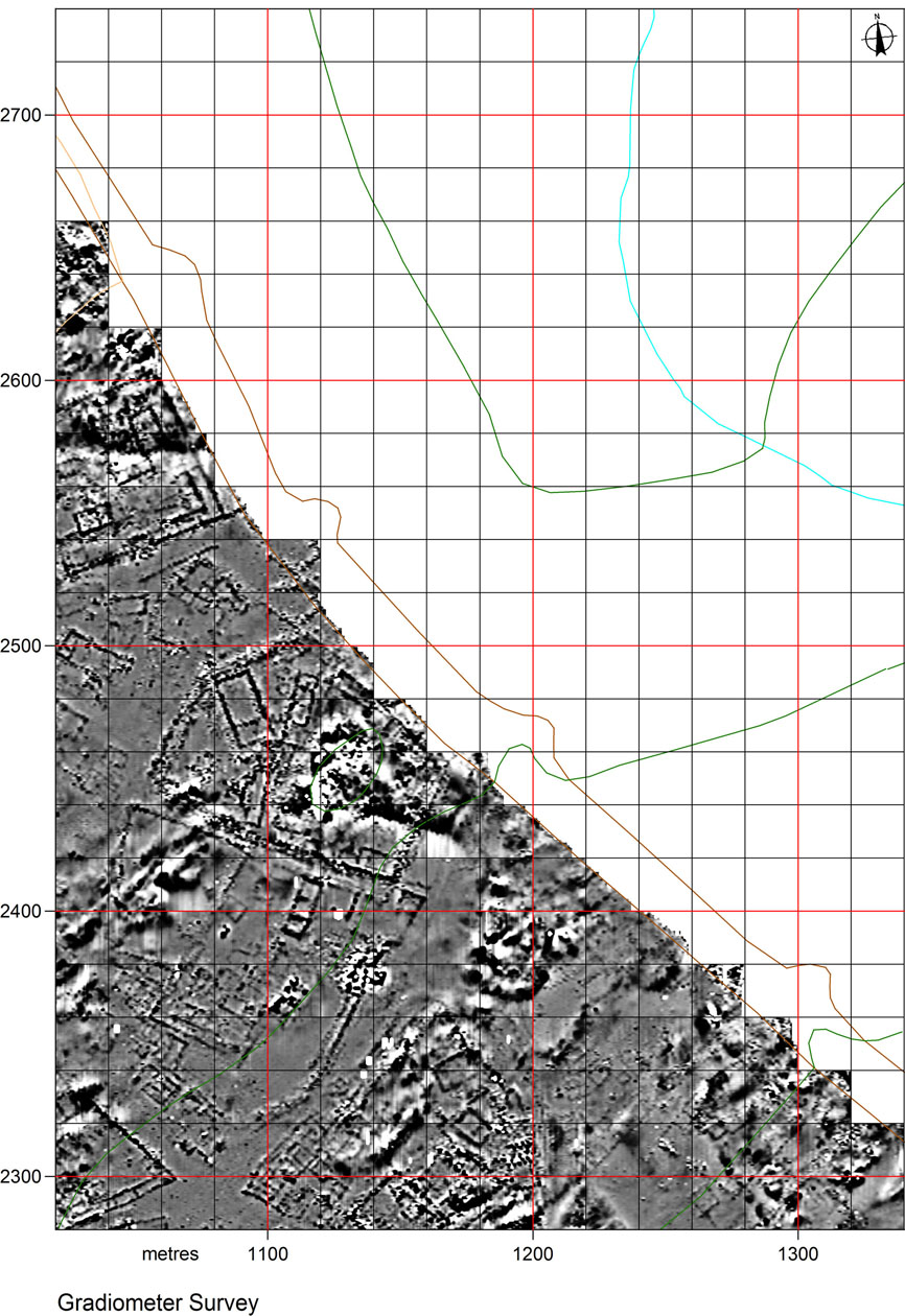
Electrical resistance survey map (top) and gradiometer survey map (bottom) of sub-surface features at the northern end of the site. Kentin kuzey ucunun yer altı öğelerine ait (a) elektrik özdirenç yüzey araştırması haritası ve (b) manyetik alan gradiyometre yüzey araştırması haritası. |
 |
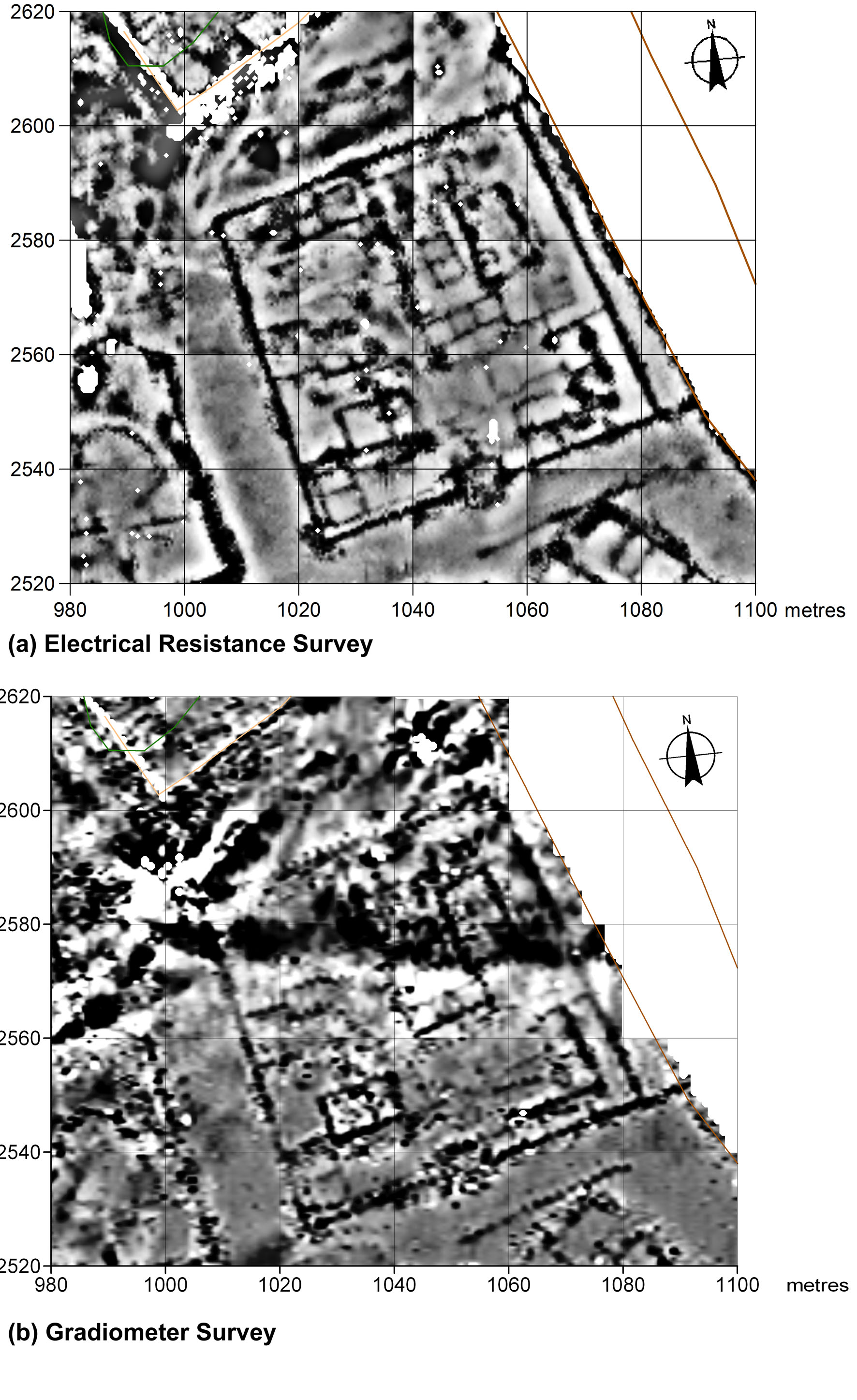
Electrical resitance survey map from 2011 showing the area inside the North Gate. Kentin Kuzey Kapısı içerisinde kalan alanı gösteren 2011 elektrik özdirenç tarama haritası. |
|
|
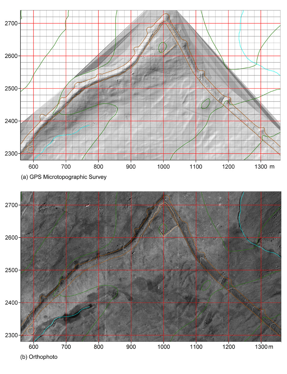
GPS topographic survey map and (b) orthophoto of the northern end of the city. GPS topografik araştırma haritası ve (b) kentin kuzey ucunun ortofotoğrafı. |
 |
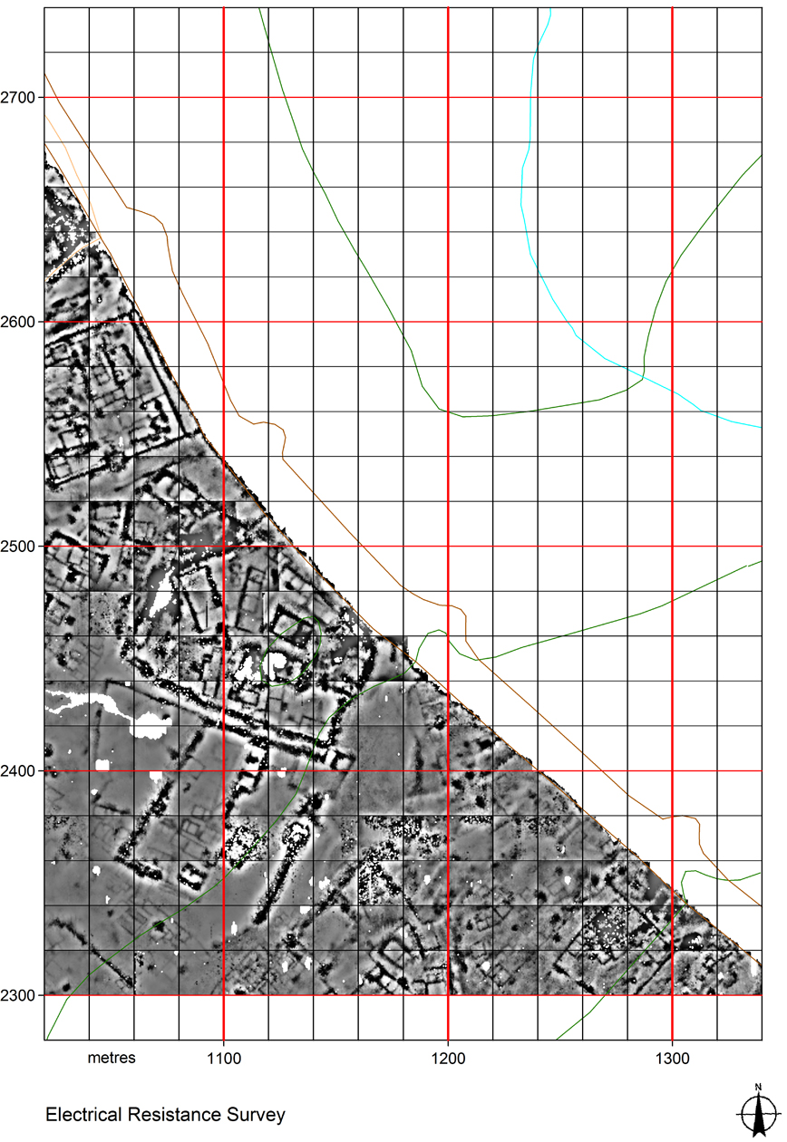
Fluxgate gradiometer survey map of the area shown in Figure 48. Şekil 48'de görülen alanın manyetik alan gradiyometre tarama haritası. |
2011
Last updated