Kerkenes Home Up << Page 3 >> Index


Kerkenes from Space:
Kerkenes can be seen from space on a satellite image. The 7km of stone defences enclose 2.5 square km of undulating terrain. This enhanced Landsat false colour image, prepared by Hayati Koyunlu of MTA, shows the city wall as a blue line and, at top, the Egri Su appears as a sinuous red feature meandering through a broad, well drained valley at the northern foot of the granite batholyth.


Kerkenes from the Air:

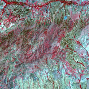
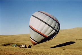
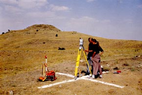
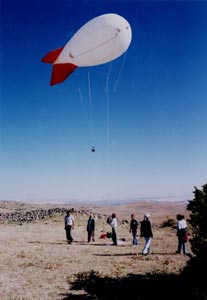
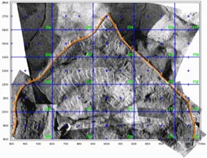
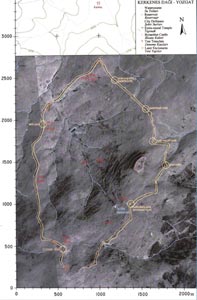
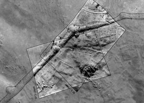
Study of such a large area of visible remains by traditional methods was a daunting prospect. Our new approach focussed on the innovative application and integration of remote sensing methods, balloon and blimp photography, geophysical survey methods, GPS and topographic survey, over a very large area. In this research design the role of excavation was to test and compliment the survey results.
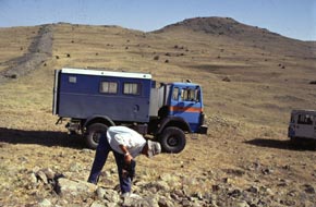
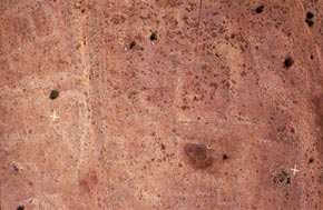
As the project progressed we found ourselves pioneering new grounds. Technological advances and the availability of more sophisticated equipment, including computing power, brought along new possibilities. We were slowly being driven into a technological world which was to become ours. A world full of difficulties and frustration!


Hot-air balloon:

We were most fortunate, in 1993, to find ourselves floating over the site in the Cloud 9 Kappadokya Balloon on a very still September afternoon. A unique chance to capture the whole site on a single picture frame and also to complete photographic coverage from greater altitudes than could be attained with a blimp.


Establishing the grid:

The first task was to establish a grid. With the help of enthusiastic students, a Total Station and, occasionally, a donkey to help carry equipment. The project did not then have a four-wheel drive vehicle! Crosses, made with white powdered lime, were laid out at 100m intervals along the 2.5km long North/South axis.


Hans the Surveyor:

Hans Birk, together with his all terrain survey vehicle, on loan from the Bogazköy expedition. Hans set out a highly accurate network of points, each marked by a titanium rod immovably set in a hole drilled deep into bedrock.


Tethered balloon photography:

The BIAA blimp and remote controlled camera were used to achieve full coverage balloon photography of the site during the 1993 and 1994 seasons. The height from which photos were taken varied from 50m to, on rare occasions when the conditions were ideal, a maximum of 800m.


Blimp Photo:
Detailed images of streets, compound walls and buildings were obtained. The crosses are 100m apart, the tether rope is visible at centre right. Once rectified and scaled, such photographs could be combined into mosaics and used as the basis for mapping the ancient city from visible remains.


Mosaic of Balloon Photos:

Mosaics of rectified balloon photographs were created. This two dimensional imagery enabled maps of the city defences, streets, compounds and watercourses to be drawn. It proved possible to perceive and understand certain urban features with more clarity than could be done on the ground.


Base Map with Orthophoto:

The first base map acquired by the project was produced by MNG Bilgisayar from stereo aerial photographs provided by Tapu ve Kadastro Genel Müdürlügü. Contours were drawn at 5m intervals. Three of the original control points had survived on the site. These points enabled us to fix our local coordinate grid on this base map. MNG also assisted in the rectification of the aerial photograph to produce an orthophoto of the entire city. This orthophoto was combined with the base map. This site map was an aid to the correct scaling and rectification of lower level photographs taken from balloons.


Rectified Balloon Photographs:

Highly detailed blimp photographs were scaled and rectified with the help of the orthophoto beneath. Visible features were digitised from the photo-mosaic.


Kerkenes Home Up << Page 3 >> Index