CONCLUSION
 Figure
34
Figure
34 |
 Figure
35
Figure
35 |
The
Kerkenes Project, since 1993, has focused on the study of the city's
urban plan and aspects of its architecture. The monumental architecture
at the “Cappadocia Gate” and the “Palace Complex”
showed that architectural stone façades display impressive
rhythmic symmetry on an imperial scale. The discovery, within the
Palace Complex, of what appears to have been a columned hall, a
type of building with clear Eastern antecedents, may lend further
weight to the identification of Kerkenes with the Pteria of Herodotus,
a place which the Byzantine geographer Stephanos called “a
city of the Medes”.
The research design has
focused on the application and development of non-destructive remote
sensing techniques because they held the potential to record and
analyse a major, imperial, pre-Hellenistic city. The rate of technological
development, in both hardware and software, since the start of the
project has been staggering. Keeping abreast of these advances,
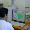
in order to remain at the cutting edge of research in remote sensing
applications and GIS analysis, (Fig
34) has been one of the central goals of the Project and, at
the same time, one of its biggest difficulties. Thanks to the dedication
of a large and diverse team, and in part as a result of clear aims
and objectives, most of the difficulties have now been overcome.
The Kerkenes Project
could be said to operate on two levels. One level is concerned with
study of a singular Iron Age city and assessments its place in cultural,
political and historical developments that were taking place in
the East Mediterranean region and much of the Ancient Near East.
The other level has been, and continues to be, the application of
state-of-the-art technologies to the study of ancient cities. At
this, higher, level the project has been pioneering; the approach
that has been developed is now being followed and adapted by a number
of other research groups. At Kerkenes it has been possible to demonstrate
that remote sensing technologies offer an entirely new way of approaching
the study of ancient cities, that targets can be set and achieved
and that budgets are reasonable compared with the traditional method
of research, i.e. excavation. The approach permits the recovery
of urban plans and building plans in such detail that urban and
architectural reconstruction can be created.
As the program of remote
sensing in the field at Kerkenes draws to an end over the next two
years, and other techniques are introduced to address other areas
of research, analysis of the remote sensing data base will continue
and other applications will be sought. A number of suggestion follow,
some theoretical some practical.
• It is essential that the raw digital data is archived in
a way or ways that will ensure not only its survival but also its
accessibility to researchers in the future.
• It is also of importance to ensure that final processed imagery
is archived in a similar manner.
• The potential for communicating the results and importance
of the research to a wider Turkish and international public ought
to be explored. The potential for public outreach includes the Web,
where our web page is primarily designed for high school and first
year university students as well as a lay public, visual displays
for Museums and perhaps for an on-site Visitors Centre should also
be considered.
• One result of the research that has been carried out, both
in the field and in the Project Office at METU, will be a human
impact on the site itself. Good or bad, it will happen, and it will
need to be managed if the remains are not to suffer irreparable
damage. It should be a relatively simple matter to adapt the GIS
data base that has been created for Kerkenes so that it can form
the basis for Cultural Heritage Management.
• At an academic level, the potential for CAD generated architectural
reconstruction at Kerkenes are enormous. As yet, little has been
done because most effort has been put into the creation of unified
database environment in GIS.
• The potential for GIS analysis of the urban dynamics still
remains to be fully tested. This is true at both the theoretical
level, particularly with regard to bias in the selection of attributues,
and at a practical level. As we learn more, both about the city
and about GIS software, it will be possible to make substantial
advances that take us substantially beyond the the superb GIS graphics
and archiving capabilities that have, until now, absorbed most effort.
One other aspect of the
Project that deserves special mention in this Report is the development
of electronic publication, through the World Wide Web and on CD-ROM.
Electronic publication does not mean putting a book on the WWW,
it means the creation, development and maintenance of interactive,
dynamic publication that is designed for electronic media rather
than for the printed page (Fig
35). The Kerkenes Web Page is a major experiment in this direction,
an experiment that is now gaining considerable international acclaim.