FUTURE PROPOSAL
The scope and aims of this project are without parallel and will lead to the construction
of quantifiable and testable explanations of the urban dynamics at Kerkenes. GIS has the
potential to elucidate and provide explanations for the evolving dynamics of the city over
its short period of existence. GIS also enables the examination of the complex interplay
between natural (e.g. topographic, water resources, micro-climatic) influences and
cultural choices (e.g. defences, vistas, juxtaposition of religious, administrative,
residential structures) urban characteristics with the urban environment.
The 1999 team is committed to follow up this study by a new proposal entitled:
THE INTEGRATION OF ARCHITECTURAL AND CULTURAL EVIDENCE IN A GEOGRAPHICAL INFORMATION
SYSTEM (GIS).
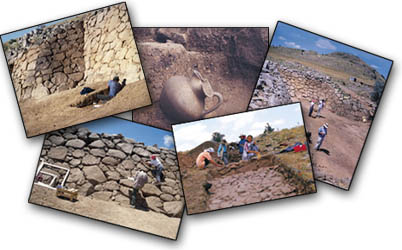
The ongoing archaeological survey and excavation programme at Kerkenes offers a unique
opportunity for the analysis of urban dynamics and architectural concepts as displayed
there during the Iron Age. Modern tools and techniques allow us to penetrate below the
surface of both the city and our understanding.