| |
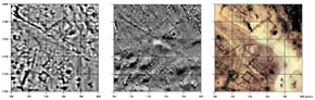
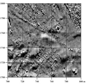
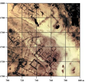
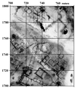
Resistivity Map:
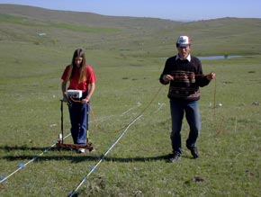
This image covers part of a larger area selected for a comparative study
of geophysical methods at Kerkenes. In this area, of the city, measuring
of 120 x 80m, none of the buildings can be seen on the surface. Unlike
with gradiometer imagery, heat induced alterations to magnetic properties
have no effect, although fire alteration to mud-brick and other materials
is significant. The background is strongly influenced by hydrology,
a streambed accounting for the broad sweep of white. The two parallel
white lines that run diagonally across the picture indicate a tractor
track.
|
|
|