Kerkenes Home Up << Page 7 >> Index


Digital Elevation Model:

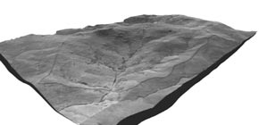
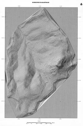
Islem GIS, using ERDAS Imagine software, made a Digital Elevation Model (DEM) of the city from the GPS data. The computer at Islem was left on all night to process the data! The Kerkenes Team was also to face 
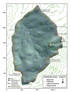
the complex issue of coordinate systems. In 1993 a local grid was set up, as described above, in which the main north-south axis was determined with a handheld compass. The origin (0,0) was conveniently placed outside the site area so that the crosses, which were marked on the ground, could be simply referred to as 'Cross 10-15' (east 1000m and north 1500m from the origin) whereas the 20 by 20m geophysical grid squares were labelled, e.g., 'e024n120' (referring to coordinate of the SW corner of the square as east 240m and north 1200m). When the GPS was first used in 1997 it was clearly not possible to alter the established grid. Conversion from UTM to our local Cartesian system had to be envisaged. We now have a set of fully converted UTM data and that it is also possible to convert all other data from the local system to UTM.


Coordinate Systems:

Known control points had allowed MNG Bilgisayar to produce the first 5m contour map from Stereo Photos provided by Tapu ve Kadastro. The surveyor Hans Birk, had added to the three known points a set of control points, now known as Hans Points, and had provided extremely precise measurements of the local coordinates. All topographic data, including the setting up of the 20 x 20m geophysical grid, relies on setting up the Total Station on Hans Points. Scott Branting was subsequently able to take GPS readings in UTM for these known points and thus formulate the conversion.


City plans:

In a pilot project data from the northern end of the city was used to digitise topological features and conduct analysis in ArcView. It is to be noted that in a subjective field such as archaeology, great caution is required in the evaluation and interpretation of data. Over-interpretation leads to biased results, but some interpretation is required in the construction of a database. Here the criteria for the selection of "layers" and "attributes" are crucial.


GIS Analysis:
Data can be displayed in ArcView and linked to information which can be retrieved when needed.


Wrapping a Photo over the Terrain Model:

Combining 2D photographic material and geophysical data images with 3D surface simulations could also be contemplated. First attempts succeeded in warping the orthophoto of the site over the terrain model.


Kerkenes Home Up << Page 7 >> Index