| 
SURVEY OF THE URBAN INFRASTRUCTURE
Survey of the urban blocks, streets,
major extant building complexes and other prominent features, using
balloon photographs and a total station, was largely completed. The
data is now being used to rectify the balloon photographs and to generate
a more complete base map of the city. Levent Topaktas and John Haigh
have further developed the computer rectification programme AERIAL in
conjunction with the Kerkenes Project, resulting in the production of
mosaics from scanned photographs which have been rectified over the
digital base map (Fig. 2). These scanned
images are now being used in the digitisation of more of the urban infrastructure
from which it will eventually be possible to produce 3D models using
state of the art graphics programmes. During the next few months we
hope to begin to design and build a Geographic Information System (GIS)
data base for the city that will become a powerful research tool, and
one to which it will be easy to add more data from future ground observations,
geophysical survey and excavations.
The results of the test excavation,
briefly summarised below, have essentially confirmed our earlier understanding
and allow us to make some important new generalisations about the dynamics
of the city. These are:
-
If we are
correct in thinking that the original city plan included a military
road running around the inside of the defences, it is now clear
that it was neither levelled nor paved, further confirmation that
the city defences were incomplete at the time of destruction and
that construction of the defences and other military installations
was probably abandoned some time before the fall of the city. Abandonment
of the hugely ambitious design should perhaps be seen against the
wider political and military concerns of the Median Empire.
-
The high southern
part of the city was set apart for public buildings, including what
have tentatively been identified as a palace and a complex of imperial
stables.
-
The enclosure
walls of the urban blocks were constructed before the structures
within the blocks, at least where it has been possible to establish
the sequence of building by ground observation and test trenching.
-
There was
continual construction within the blocks throughout the (relatively)
brief life of the city. Construction methods, especially types of
building foundation, evolved in response to the nature of the sub-soil
and to availability of stone in the immediate vicinity of new constructions.
For example, early walls are of constant thickness from top to bottom
with a base course of very large stones set on edge, whereas some
later walls have deep and wide foundations generally built of smaller
stones. One surprise was the very widespread use of timber framed
mud-brick superstructure, another was the very extensive stone paving
of external and unroofed areas within the urban blocks. There is
also evidence, in the form of burnt debris used in the construction
of secondary structures, of a fire or fires before the final torching
of the city.
-
The blocks
along the north-west and north-east sides of the city contain complexes
with large and impressive residential and other structures that
contain “high status” objects, suggesting aristocratic
inhabitants. There is considerable variation in the size of blocks
within different zones of the city. It would seem that there is
a strong relationship between the size of blocks and the availability
of water, suggesting that it will be possible to determine the relative
desirability, wealth and status of different residential areas.
-
The population
numbered thousands rather than tens of thousands. Large area geophysical
survey will enable more precise estimates to be made.
-
Commercial
and industrial areas have not yet been identified, another goal
for future geophysical survey combined with test trenching.
|
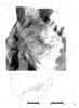
Fig.2
|


