Click to enlarge Click to enlarge
Fig. 1 Fig. 2

Click to enlarge

Click to enlarge

Click to enlarge

Click to enlarge

Click to enlarge

Click to enlarge

Fig. 3

Fig. 4

Fig. 5

Fig. 6

Fig. 7

Fig. 8

Click to enlarge

Click to enlarge

Click to enlarge

Click to enlarge

click to enlarge

Fig. 9

Fig. 10

Fig. 11

Fig. 17

Fig. 18

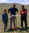
URBAN PLANNING

In the 1999 season the city plan was greatly extended (Figs 1 & 2). Detailed kinematic GPS mapping of surface topography now covers the greater portion of the city and will be completed in the year 2000. Geomagnetic survey greatly extended Area A at the southern end of the site and now also covers all of the northern and much of the central areas. Each of these elements is reported on in detail below.

Geophysics
Non-intrusive geophysical survey continues to be the major research tool at Kerkenes because it reveals sub-surface features in remarkable detail, with great efficiency and is very cost effective (Figs 2-3-4-5-6-7-8). 
     

click to enlarge
Electrical Resistance Survey

click to enlarge
Geomagnetic Survey


Electrical Resistance Survey
Experiments with electrical resistance survey were carried out in the spring season and in the early part of the summer season. The aims were to see if this method would locate features not visible on the magnetometer images, particularly stone column bases. The columned hall in Area B was selected because excavation in 1996 had confirmed the existence of stone bases. It is also anticipated that resistivity survey will indicate different types of surface and flooring, and may make possible the construction of pseudo-sections. Equipment problems in the spring and exceptional dryness in the early summer meant that results were inconclusive. It is intended to make an application for a permit that will allow new trials in the spring of 2000.

Geomagnetic Survey
Geomagnetic survey with a GEOSCAN fluxgate gradiometer covered 20 x 20 m. grids, a total area of 52800 m2 (Fig. 2). Young men from Sahmuratli Köy have been trained to collect and download data, undertake preliminary processing and print out daily results. By working 2 shifts per day it has been possible to collect data from up to 40 grids per day. The use of a pre-release version of GEPLOT has facilitated processing and printing of composite images despite initial teething problems of hardware incompatibility. The acquisition of a new A colour printer in addition to the large format Epson printer has facilitated the regular production of images for ground-truthing. (Images need to be checked on the ground to distinguish later features, such as animal, as well as bedrock and shrubs from the images of Iron Age structures. Ground-truthing also enables the recognition of surface features, such as wall-lines that are sometimes obscured on the magnetic images by the proximity of outcropping bedrock.) 

GPS mapping
GPS mapping of surface topography with one base station and three roving receivers continued in 1999 (Figs 1 & 9). The resulting image now covers some 80% of the city and is generated from a total of 1,286,767 data points of which 886,377 were collected in the 1999 season. Accuracy is to within 10 cm.


         click to enlarge
GPS mapping of surface topography

Geophysical images and balloon photographs are draped over the topographic maps and the vertical scales are increased in order to give a realistic impression of the topographic features. These electronic graphics can be manipulated and enhanced in a variety of ways (Figs 10 & 11).

Urban Blocks at the Northern End of the City
Two geomagnetic images of typical urban blocks are presented here. The first (Figs 4 & 5), measuring some 60 x 60 m, contains several substantial, rectangular, structures that the high contrast would suggest have been heavily burnt. Fainter rectangular features within the same block might suggest the existence of greater overburden. The second block, illustrated at a larger scale, measures approximately 40 x 40 m with a 20 m wide complex adjoining its south-east side. The most prominent structure, a row of three small square rooms, is a form of building that frequently occurs at Kerkenes.

Public Buildings on the Southern Ridge
The Area A geomagnetic survey was extended westwards to cover the “palace complex” and adjacent areas and eastwards over the Sülük Göl, the “Polo Field”, and the terraced structures above (tentatively identified as imperial stables of storehouses in previous campaigns) (Figs 6, 7 & 8). Some areas of the “Palace Complex” were surveyed at a higher sample density than is usual at Kerkenes (8 readings per m rather than 4) in an attempt to obtain images with greater clarity in areas where the terrain was difficult or where the fist images showed the existence complex structures with little detail.

'Palace Complex'
Clearance of the “Palace Complex Façade” (see below) revealed a blind re-entrant rather than a monumental entrance (Figs 7, 17 & 18). The “Complex” itself appears to contain a number of independent monumental buildings that are not (yet) paralleled elsewhere within the city. A combination of magnetic survey and observation on the ground following an exceptionally dry spring has yielded a plan showing considerable detail and superseding the provisional plan drawn on the basis of ground observation in 1997.

The “Polo Field” and Terraces Above
Geophysical survey confirmed the plan drawn from surface observation in previous seasons and added little significant detail (Fig. 8). In particular, no evidence was seen that could be interpreted as supporting roofs over the large units (although it is known that stone column bases do not necessarily show up on geomagnetic plans). An important and surprising addition to the plan was the very clear image of a gate-like entrance building to the largest of the terrace. This important structure was heavily burnt during the destruction of the city (indicated by the strong polarities on the geomagnetic image). The building measures 40*40 m, and comprises three aisles divided by two rows of 3 columns. The plan and position of this structure provide corroborative evidence that these terraced structural units had some centralised public (military and/or administrative) function, almost certainly connected with the passage of materials and animals through the South or “Cappadocia” Gate. No trace of this aisled structure is visible on the surface.

Buildings to the North of the Palace Complex
Across the street from the “Palace Complex”, within a prominent urban block, geomagnetic survey revealed the existence of a large hall with two rows of columns, measuring 30 m with a columned anteroom measuring 15 m (Fig. 6).
   

page 2

linesh.gif (75 bytes) tr.gif (1358 bytes) line.gif (171 bytes)