 |
||||||
|
Cover |
Page 2 - 3 |
Page 4 - 5 |
Page 6 - 7 |
Page 8 - 9 |
Page 10 - 11 |
Page 12 - 13 |
Page 14 - 15 |
|
|
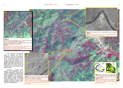
| This
Quickbird multispectral image of Kerkenes was used in combination with
the panchromatic version for automatic feature extraction of the archaeological
features. Three classes of data were identified on the Geophysical imagery
for this process. In this pilot study, which formed the core of Nahide
Aydin’s MA at the University of Mississippi (Fig. 16),
almost 40% of the features were correctly classified on the Quickbird
image. |